Geography
Geography has always been a passion of mine, fueling my curiosity about the world and its connections. I love exploring the stories behind landscapes, cultures, and borders, and this interest has inspired me to create my own maps, some of which are showcased below. For me, geography is where science meets storytelling, and it’s a field I’m excited to keep exploring and sharing with others.
Iceland Lineshade
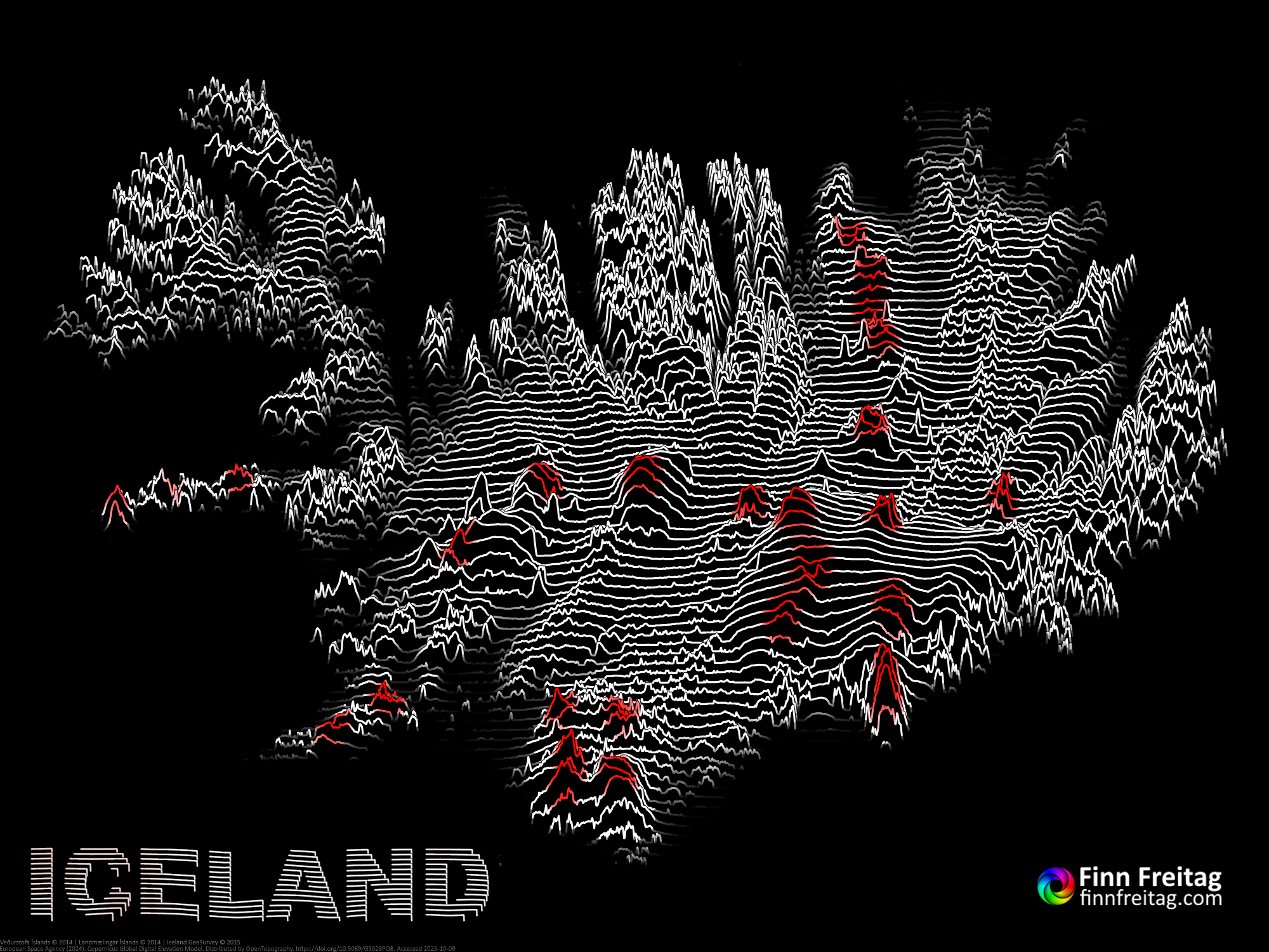
11/6/2025© Finn Freitag
This map shows Iceland using elevation contour lines to visualize its terrain. The white lines trace the island’s mountains and valleys, while red tones mark volcanic regions in the center and south. The dark background helps the landscape stand out clearly, giving a simple yet detailed view of Iceland’s varied geography. I created this map using a custom heightmap to lineshade converter. Data from ESA, distributed by OpenTopography and Veðurstofa Íslands, Landmælingar Íslands, Iceland GeoSurvey.
European Island Discoveries
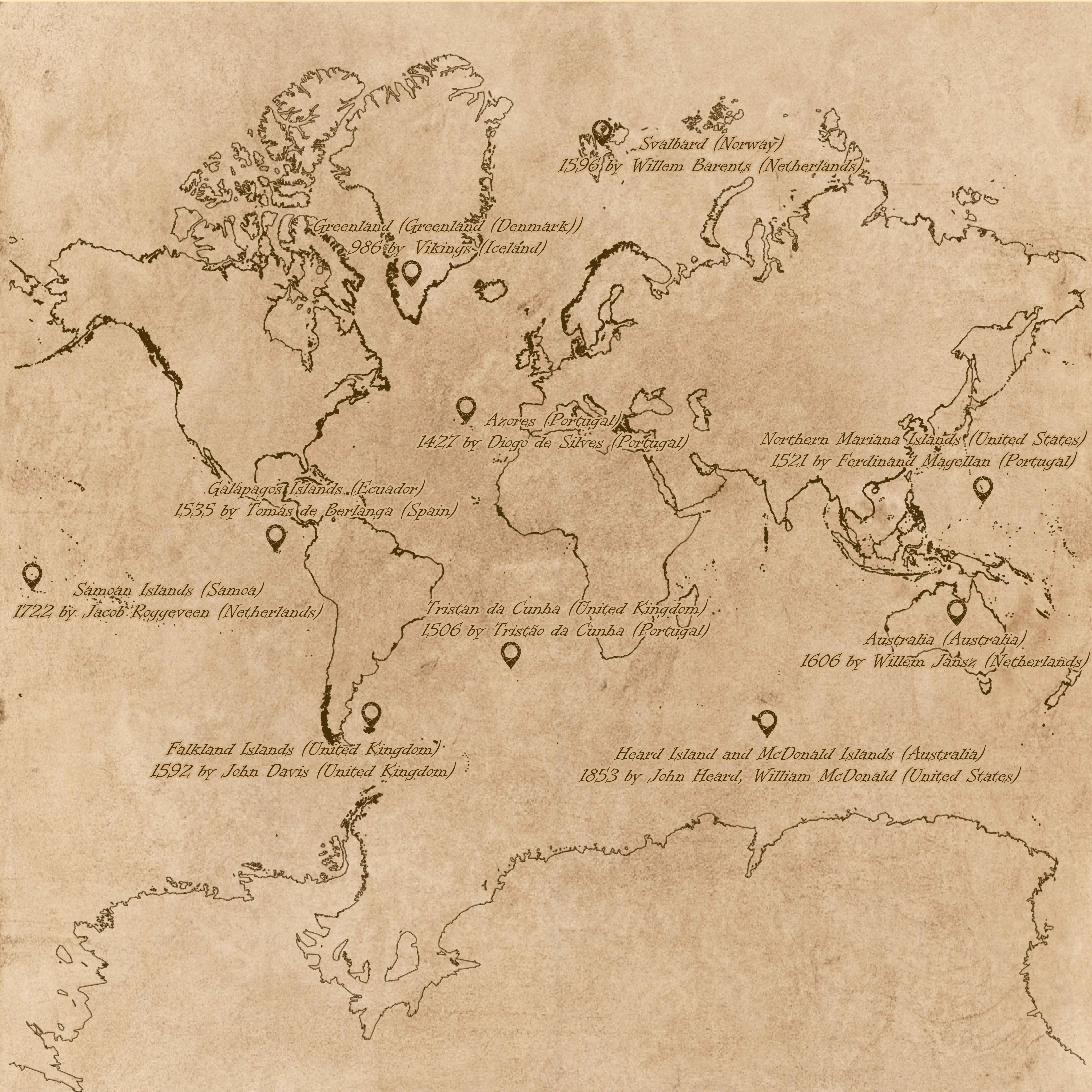
12/26/2024© Finn Freitag
This map shows 10 more or less well known islands and when they were discovered by which explorers. The dates always refer to the first official discoveries by European explorers. Some islands were already inhabited by indigenous people. Data from Wikipedia.
Voronoi Countries
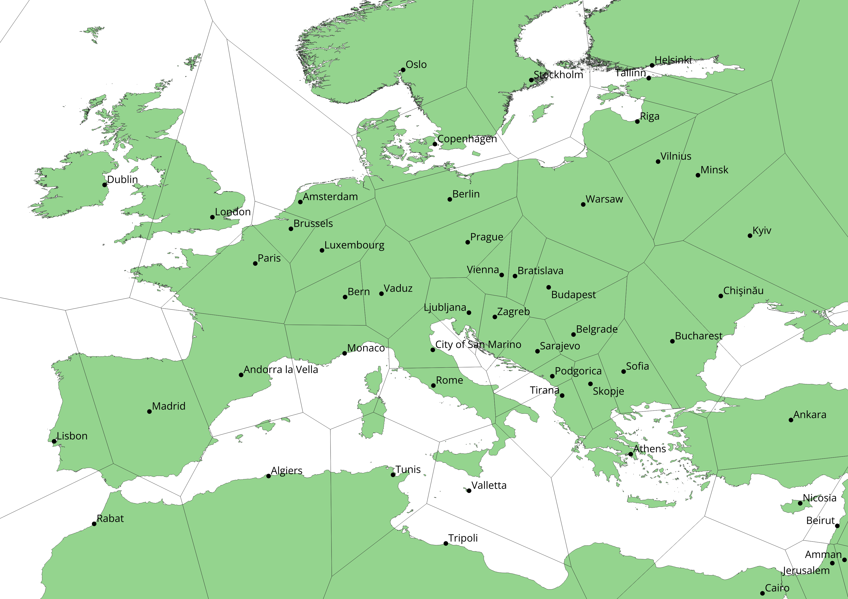
11/2/2024© Finn Freitag
This map shows how country border would look like if all points on earth where distributed to their next captial. To calculate the new borders I used the Voronoi algorithm.

Impressum/Imprint | Privacy Policy | Copyright © Finn Freitag 2024 - 2026, All rights reserved. | Other copyright notices